World Heritage Struve's Geodetic arc
This was the first technical and scientific object to be included in UNESCO’s World Heritage list in 2005. It stretches for 2820 km through ten countries. Along the arc, 34 geodetic points have been chosen to represent this world heritage. Four of these points are in Norway.

People have known for a long time that the earth is round and that it is flattened at the poles. But no-one knew its exact shape and size. This was determined by a chain of survey triangulation, and a part of a geodetic arc was measured by triangulation. The breadth of its end-points was decided by astronomical observations. When you knew the length of the circle and its angle you could calculate the earth's curvature and its radius at the equator.
From 1816 to 1855 the survey of triangulation were taken from Fuglenes in Hammerfest to Ismail in the Ukraine. It was the astronomer Friedrich Georg Wilhelm Struve who led the whole project. In Norway the astronomer Christopher Hansteen was in charge of the measuring. These measurements were carried out from 1845 to 1850. There were two military surveyors and one scientist, who spent four summer seasons on the task.
At that time it was a major challenge to measure a distance of 2820 km. First they measured a chain of triangles, a survey of triangulation of figures, and angles between sight lines to the points. In Norway there were 15 main points and 8 subsidiary points. One short distance was measured in Alta as a basis line. This formed an extended triangulation net which was connected to the survey of triangulation figures from Fuglenes to the Finnish border.
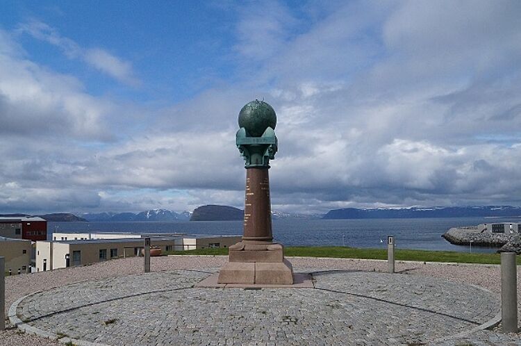
The four points that Norway has chosen as World Heritage sites represent important parts of the method. The Meridian statue in Hammerfest is the end-point. Lille Raipas in Alta is a key point on the extended triangulation net. In Kautokeino the selected point is Luvddiidcohkka or Lodiken which joins the survey of triangulation with the exptended triangulation net. Here, too, is the point Bealjasvarri or Muvravarri which was essential for the survey of triangulation southwards to Finland.
Read more about the World Heritage Struve's geodetic arc: www.struve.no